- Description
- Model Details
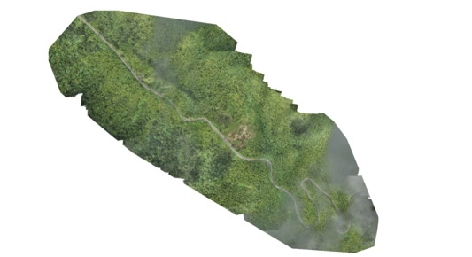
Experienced team providing mapping services of flights through photogrammetric data product development, specializing in large scale, very high detail captures. Capable of offering MSI data, contour lines, etc. One of the first companies in the US to have received a WingtraOne Gen II, the premier utility UAV system in the world. Survey grade accuracy at around 1.5 cm/px and capable of about 400 acres per flight, many flights in a row. Largest job to date was 13,000 acres in 5 days at cents on the acre. Became first team to fly in El Yunque National Rainforest last September working as a subcontractor for the U.S. Forest Service. Based in Florida, experience traveling to locations for larger projects. Offer reflects our standard rate per flight, custom pricing to job available. Check out our website precisioneco.com and feel free to email me at benjamin@precisionecology.com
Model details and specifications are coming soon!

 Brand: Mapping
 Model: --
 Condition: Other


