- Description
- Model Details
Purchased this LiDAR brand new in 2020, has never been used looking to off load due to the shortages in sensors, I paid $43,000.00 USD.
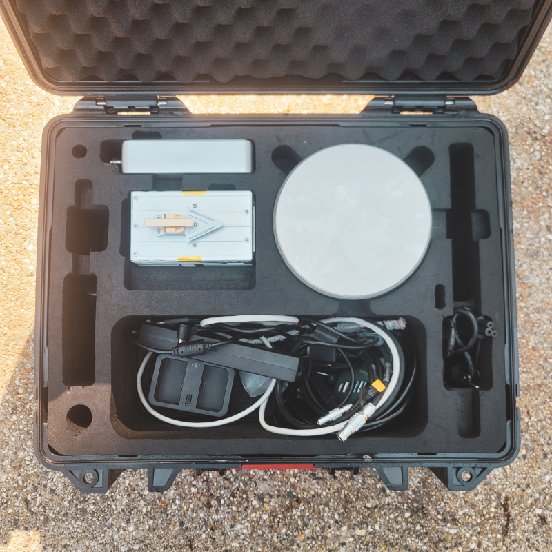
LiAir V is a newly designed, light-weighted airborne LiDAR system of GreenValley International. Powered by the revolutionary laser scanner, Livox Mid-40, LiAir V has become the most cost-effective LiDAR system in the LiAir series. With high flexibility (can be mounted on both DJI M200, M300 RTK and DJI M600 Pro), LiAir V can provide high-accuracy point cloud of different environments for the users in various industries, e.g. surveying, forestry, power line inspection.
Acquisition & GNSS/INS Post-Processing Software
LiAcquire is the one-stop software for acquisition and post- processing for LiAir V. LiAcquire monitors the data acquisiton process in real-time, processes GNSS/INS data to generate scanning trajectory in cm-level accuracy, uses it to georeference point clouds and images, and outputs an quality report for performance evaluation.
Mission Planning Software
LiPlan is a UAV ground station application designed for LiAir series. LiPlan automates flight route generation following user- defined Region of Interest and surveying parameters, and with the one-button take-off design, LiPlan auto-pilots through the calibration figure-8 maneuvers and data acqusition flight routes.
Model details and specifications are coming soon!

 Brand: Cameras
 Model: --
 Condition: New


